Our dive center is located in Mahahual, where the southern tip of the Mexican Caribbean lies an unscathed paradise for divers and anyone looking for adventure. Mahahual, originally a small fishing village, has developed over the years to be an oasis for divers and travelers looking to relax and absorb the Caribbean vibes. Located just south of Playa De Carmen and Cancun, this white sandy getaway is just a stretch away from the hustle and bustle. Part of the Mesoamerican barrier reef, Mahahual waters offer a multitude of underwater biodiversity and impressive reefs untouched by civilization for hundreds of kilometers. The reef consists of more than 300 types of coral, 350 types of mollusks and more than 500 types of fish, of which a large number are protected including the world’s largest population of manatees. With unspoiled mangroves just a few meters from the beach, there are hatcheries that provide refuge from hundreds of species. This kind of ecosystem not only helps and supports the life in the ocean but also attracts a lot of migratory bird species looking to feed and breed in the safety of the mangroves.
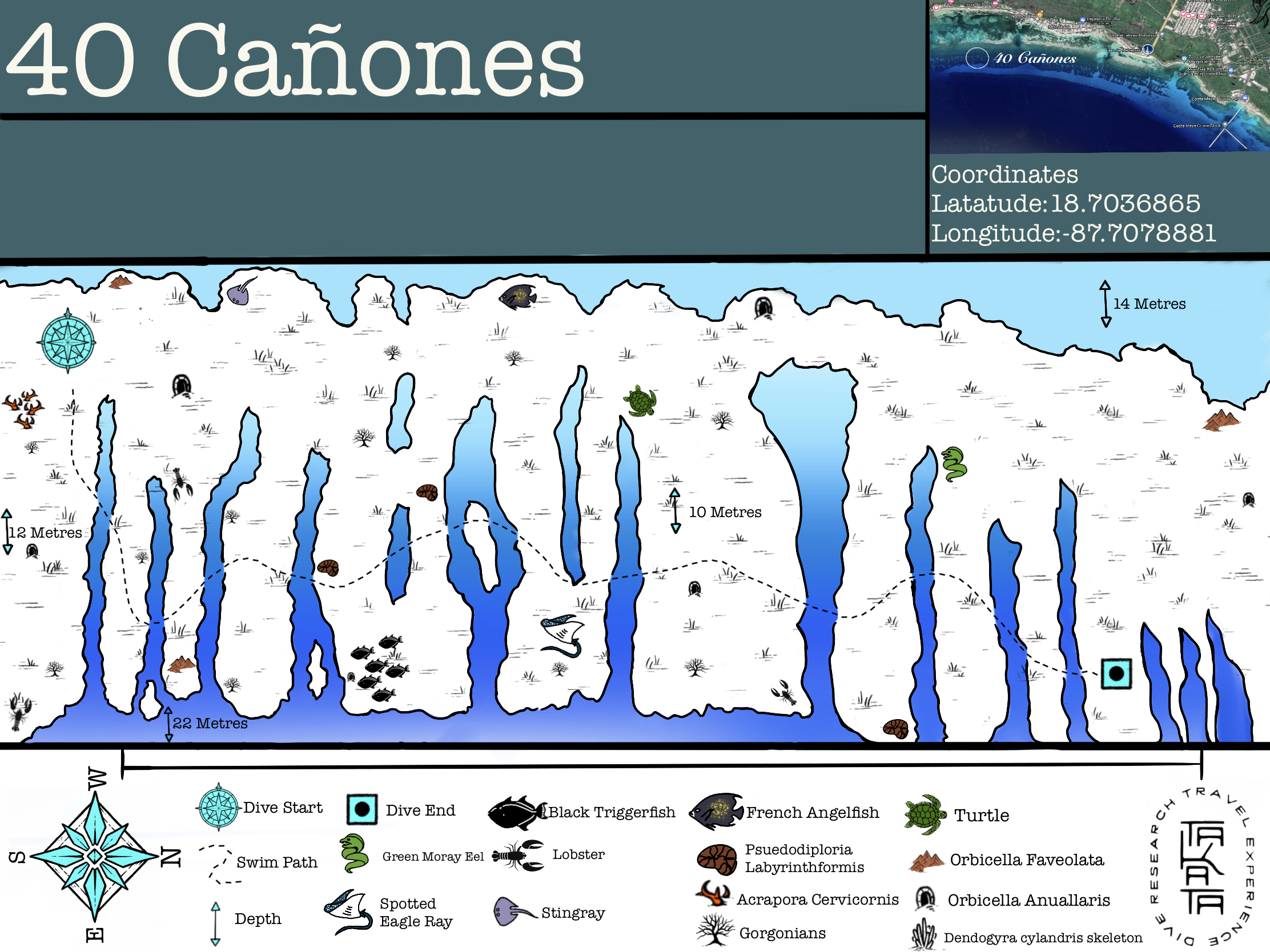
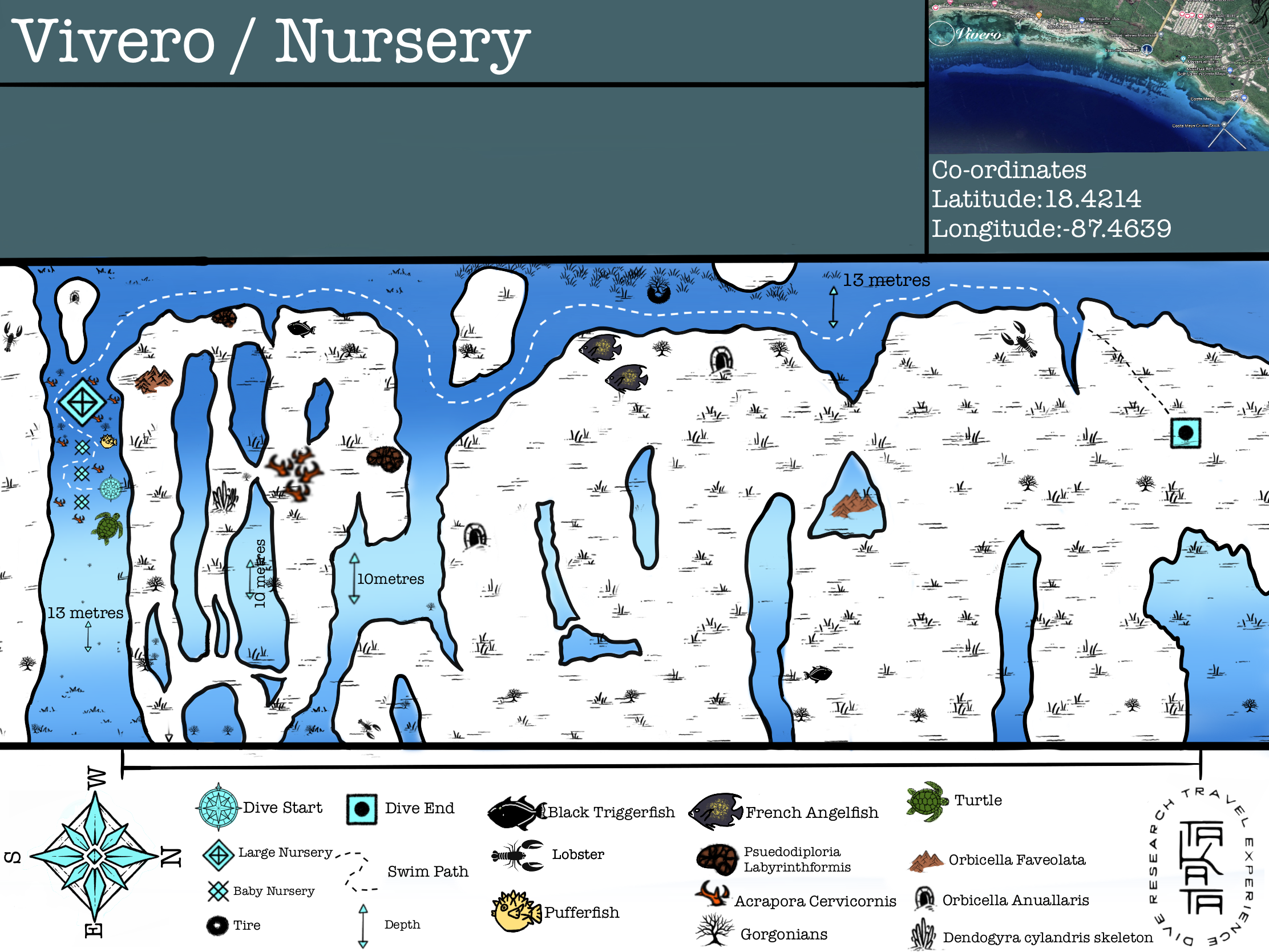
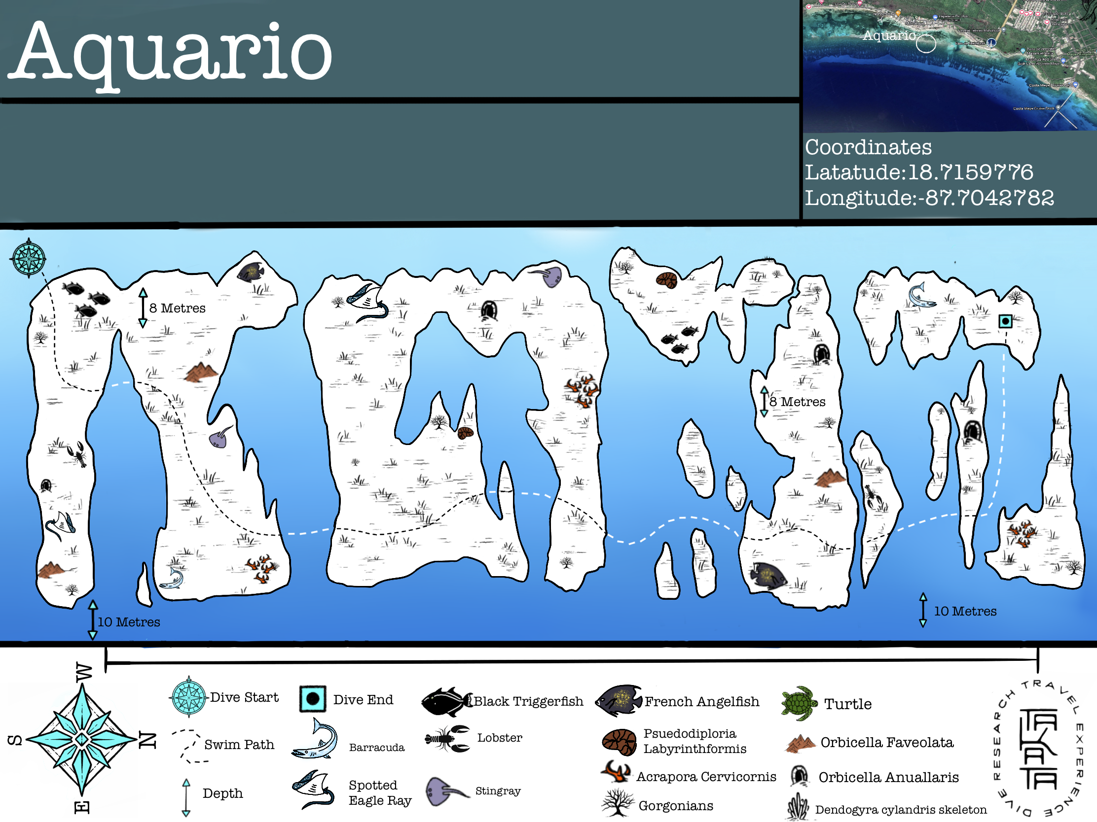
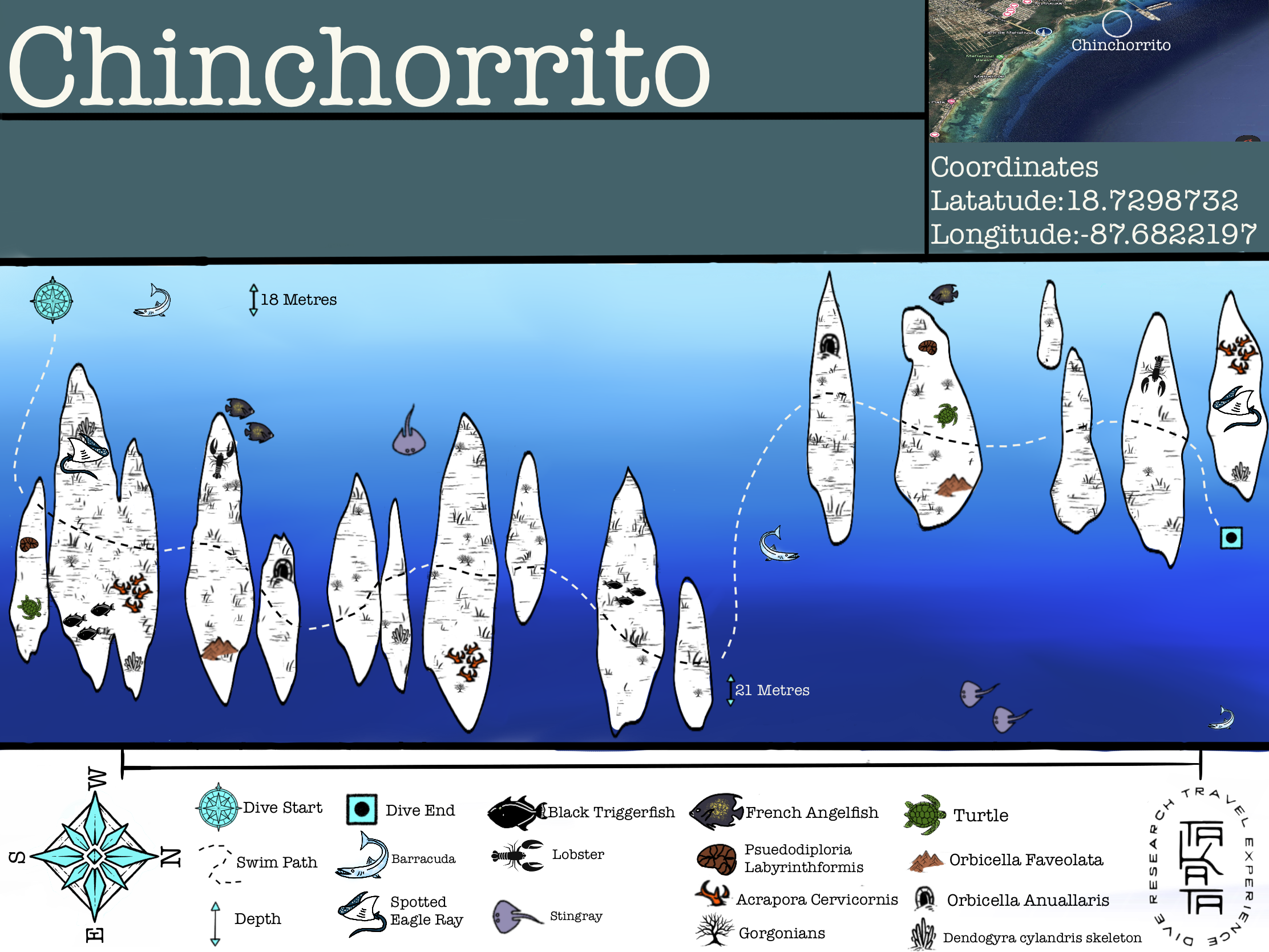
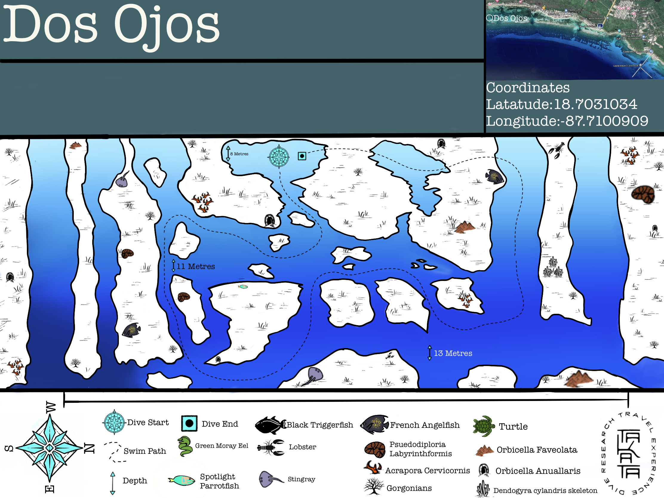
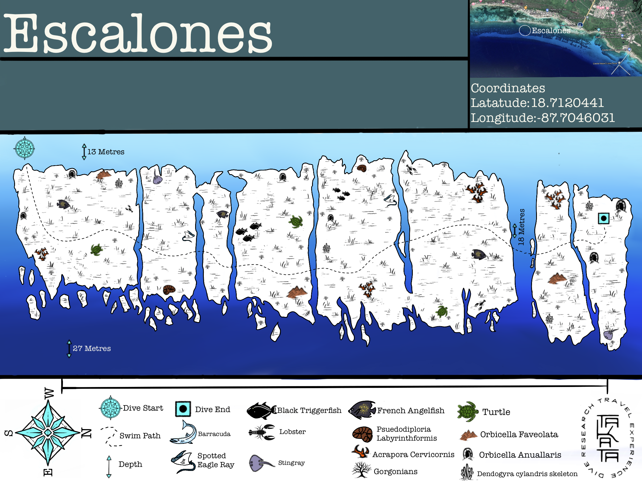
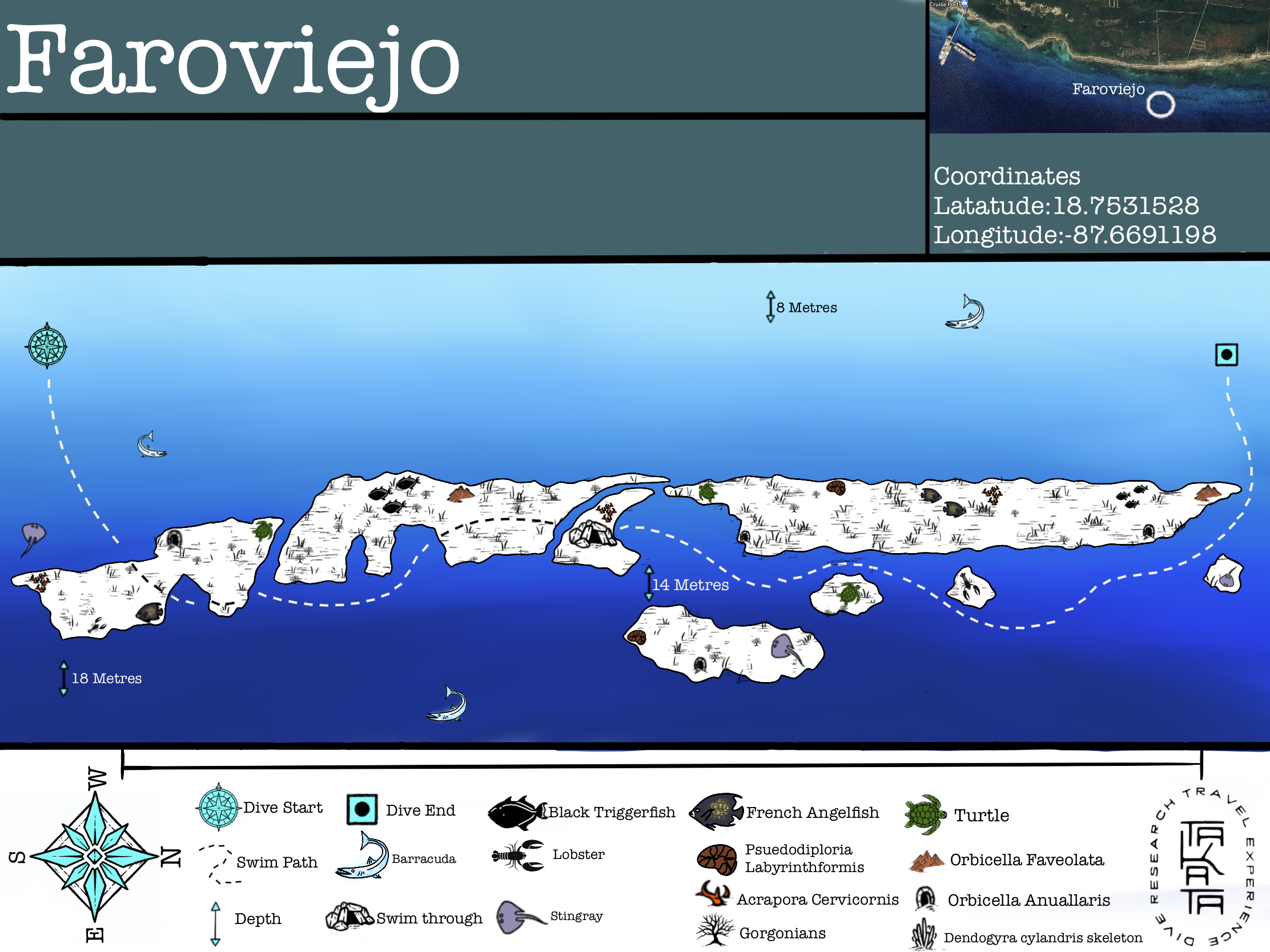
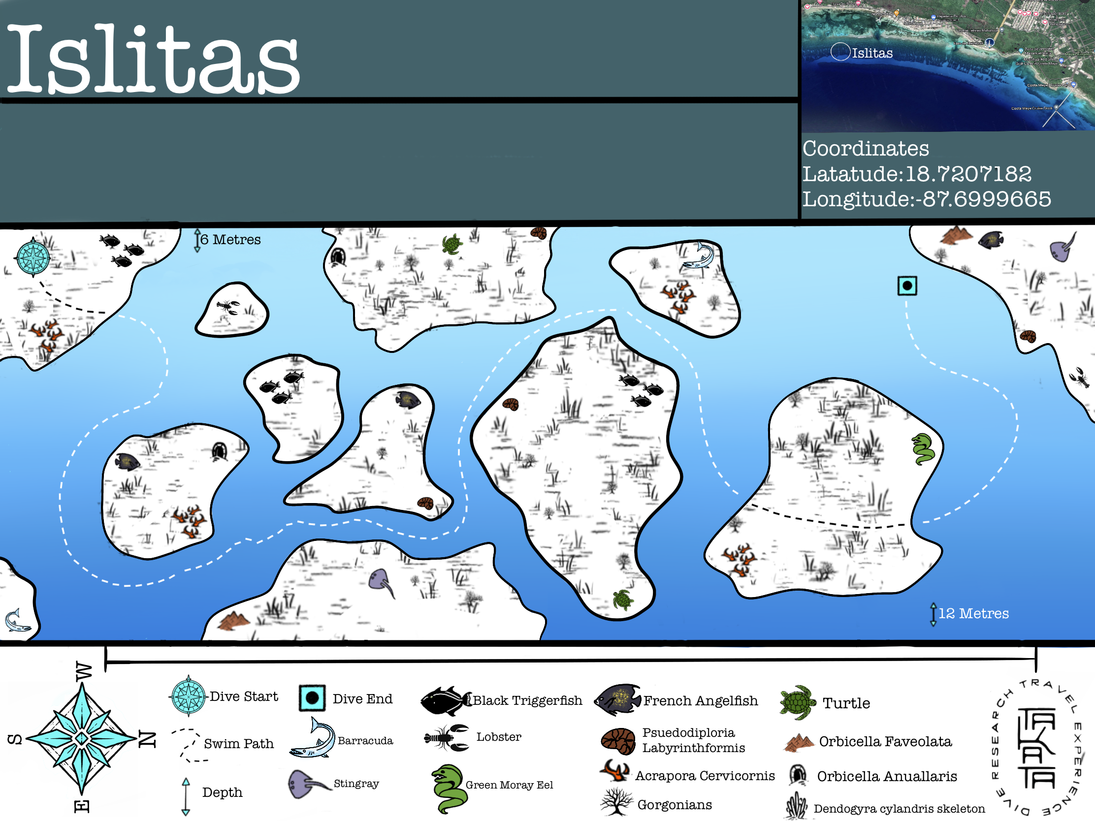
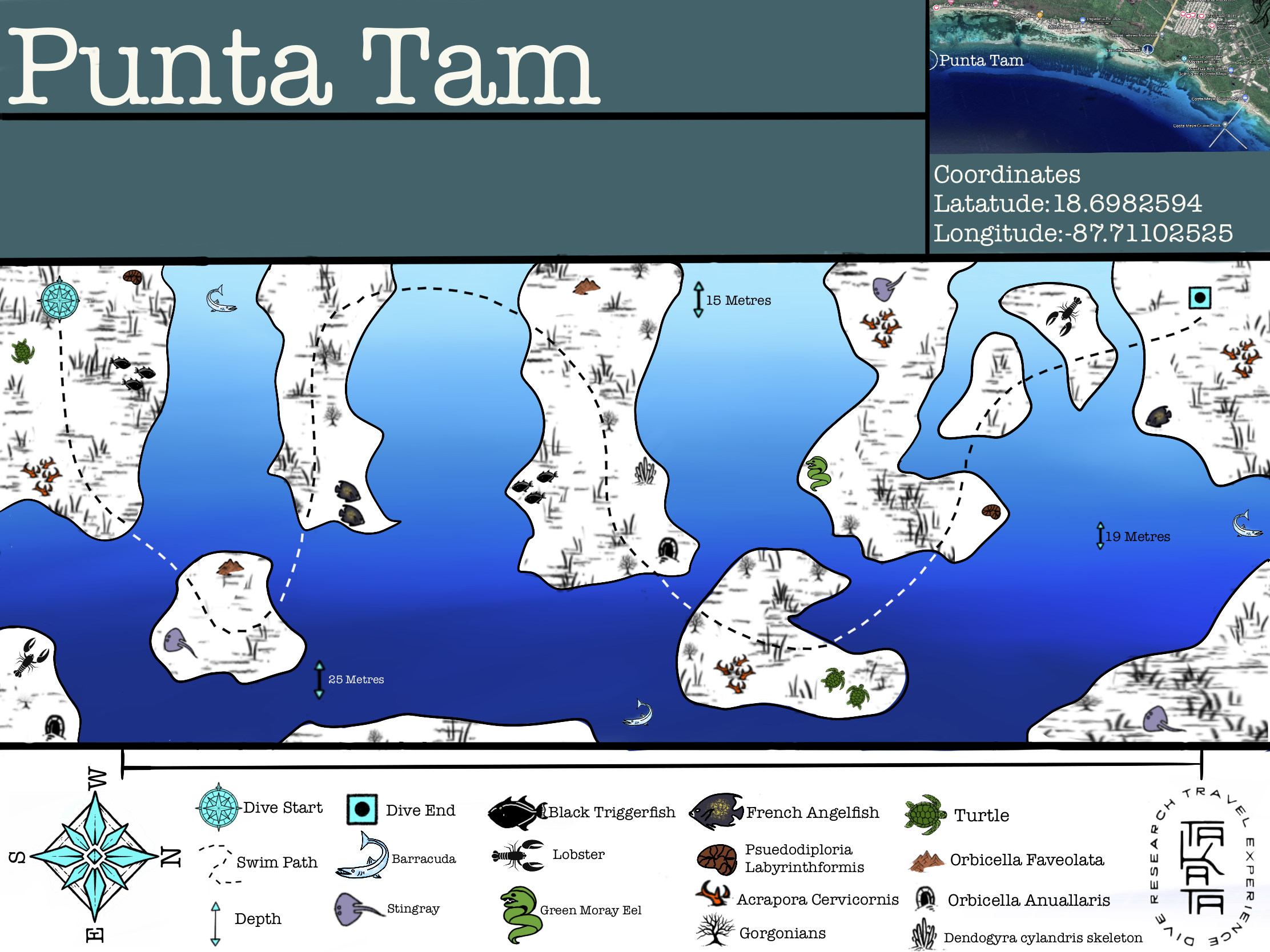
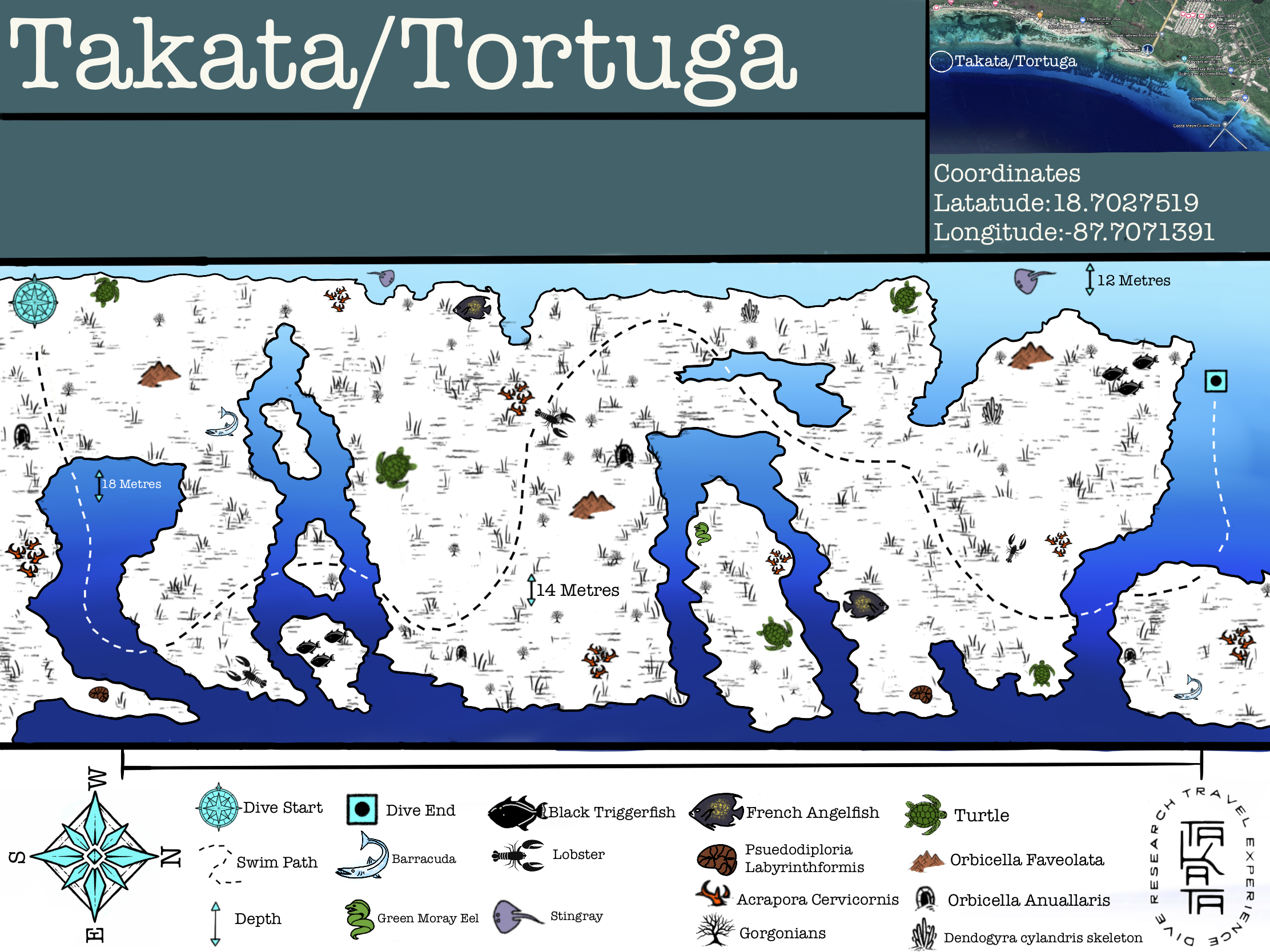
Mahahual Dive Map
Mahahual Dive Map
Mahahual Dive Map
Mahahual Dive Map
Mahahual Dive Map
Mahahual Dive Map
Mahahual Dive Map
Mahahual Dive Map
Mahahual Dive Map